

City of Covington Cemetery Maps & ArcGIS Mapping of Cemeteries
Below you will find a downloadable map of the Southview and Westview cemeteries. Further down the page is a newer feature that allows you to search our GIS data for specific burial details.

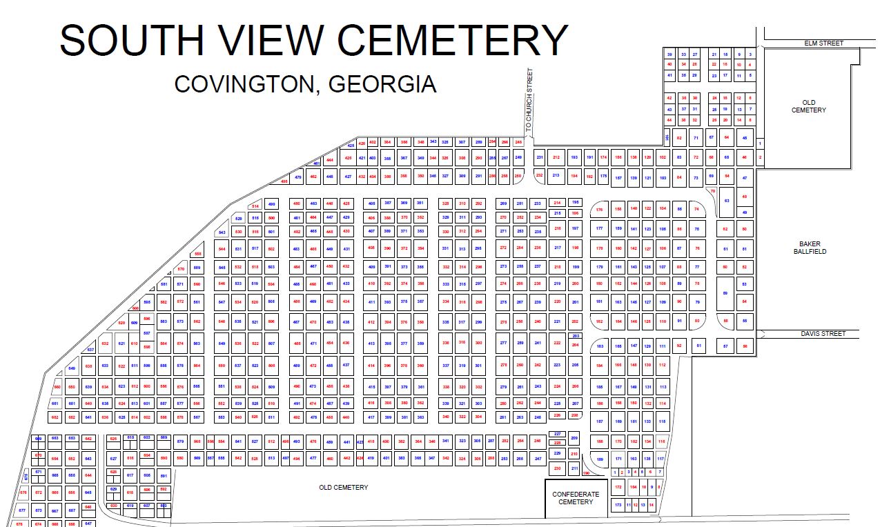
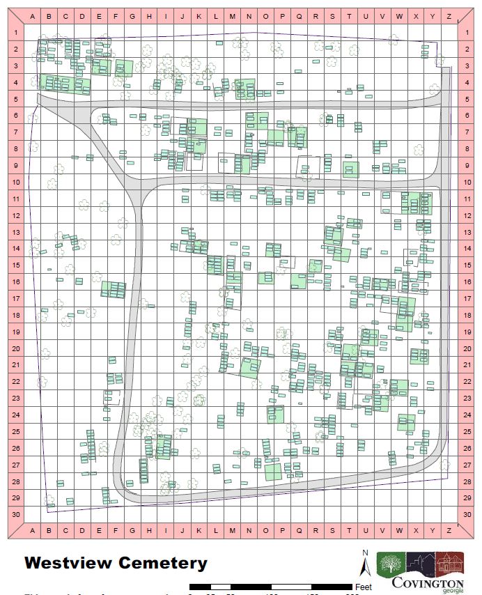
Select the image below to enlarge the map.
Southview Cemetery Map
Westview Cemetery Map


ArcGIS Web App for the City of Covington Cemeteries
With this application, you will be able to search our GIS data for specific burial details. Included in the app are various layers that deal with different aspects of our cemetery data, such as burial points, copings, etc. Within those layers, you can find even more information such as family name, date of birth, date of death, veteran status, etc.
Select here to visit the ArcGIS Web App for the City of Covington Cemeteries.
Once you visit the web application, if you wish to locate a specific person or coping, there is an 'Info Summary' button and a 'Search' bar, both located in the top left corner. If you wish to filter data using a specific requirement, there is a 'Filter' button located next to the Info Summary button and underneath the Search bar. Some other available tools that are at your disposal include Query, Share, and Print. There are many more features to discover and many more we can add if necessary. If you have a suggestion for how we can improve this application, please do not hesitate to contact us.
** The City of Covington and all other entities involved in the GIS mapping process hereby disclaims any warranty or any other liability for the accuracy of this data, in printed or digital format. All data provided by said entities is for informational and for planning purposes only, and may not be relied upon as evidence of the location of property lines, topographical features, landmarks, monuments or for any other legal purpose. Any questions about the GIS mapping process can be answered by calling City of Covington GIS at 770-385-2000. **